This article provides background information on how the DATE Indo-Pacific region was developed, introduces several new operational environments (OEs) within the region, and highlights several upcoming efforts. The purpose of this article is to help readers understand the evolutionary nature of DATE and to encourage engagement in shaping future developments.
ORIGIN OF THE DATE PACIFIC REGION
In 2018, the Army’s Chief of Staff identified the need to expand training to include more regions globally, allowing for training in OEs supporting any potential theater of operation. The 2018 expansion of DATE helped to address the needs of the Army and set in motion the ability of DATE to meet the training needs of other U.S. military branches and partner militaries. Allies from the British Army, the Australian Defence Force, the New Zealand Defence Force, and the Canadian Armed Forces collaborated to develop three new DATE regions: Africa, Europe, and the Pacific.
Initially, DATE-Pacific included five composite countries overlayed onto the island groups of Luzon, the Visayas, Mindanao in the Philippines, and the northern portion of the island of Borneo. The five composite countries represented five different types of countries found within the Indo-Pacific region (see Figure 2)
UPDATING THE DATE-PACIFIC REGION
As Army priorities shifted over the years, the requirements for training scenarios in the Pacific swung from enabling peninsular fights to countering the pacing threat. Although DATE’s flexibility as a training aid allowed scenario developers to adapt the existing five countries to meet emerging needs, DATE-Pacific needed to evolve to support the new focus fully. This adjustment occurred in two phases over the past several years.
PHASE 1: MODERNIZATION
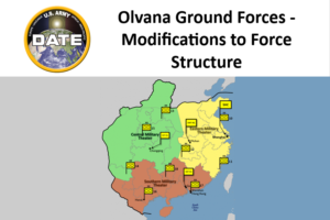
The first phase occurred in 2020-21. The existing countries were updated to better reflect potential adversaries’ emerging tactics and doctrine, including a shift from North Torbia to Olvana as the primary threat focus (what would later be referred to as the pacing threat). This update enhanced the discussion of the space and cyber domains to fully reflect all five domains. Additionally, the scope of DATE-Pacific was expanded to enable training for echelons above brigade, which required the development of more cohesive strategic narratives.
The first phase focused on updating the original content. It did not address challenges associated with the physical terrain of DATE-Pacific. When TRADOC G-2 first began supporting the development of a common scenario in the Pacific, several OE characteristics were identified as paramount for meeting objectives. Among these requirements were the need to fight multiple corps, the necessity to sustain that fight, the ability to support both light and heavy operations, and the always challenging requirement of a river crossing.
Insufficient territory/space: DATE Pacific was originally centered on the island of Luzon as the largest territory in the region. This territory was sufficient when the focus was on brigade and below operations but was not large enough to meet scenario requirements for many professional military education staff exercises. The DATE Pacific construct was unintentionally forcing scenario designers into a dilemma where they either had to shrink their force structure or shift the actors to a different territory.
Getting to and sustaining the fight: Fighting on a scattered archipelago presents numerous persistent logistics challenges that often require joint force solutions. The conditions frequently caused difficulties beyond the scope of learning objectives, leading to scenarios where sustainability considerations are ignored. Having a training OE that can present these joint challenges is essential, but having a training OE that requires these joint challenges to be addressed in every scenario creates challenges that undercut the applicability of the training OE.
Tanks in the Tropics: Assuming that the logistical challenges were not a showstopper, the need to fight units ranging from light infantry to heavy armor presented the next challenge. The tropical climate and heavy rain on Luzon are key characteristics of the OE that would make the maneuver of heavy formations unrealistic.
PHASE 2: EXPANSION
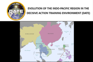
The second phase set out to address these challenges. DATE-Pacific needed more space, the ability to sustain realistic scenarios (without sustainment overtaking the scenario), firm ground, and we needed to find rivers (but not too many). To meet these new requirements, DATE-Pacific expanded into Southeast Asia and was renamed DATE Indo-Pacific.
Expanding into Southeast Asia helped solve the challenges of having space and reducing the sustainment challenges, but the requirements to support scenarios with heavy armor and river crossings still needed to be addressed. After searching far and wide and testing the limits of Google Streetview, it was decided that the region spanning from the Khorat Plateau to central Thailand fit the bill.
After focusing on specific terrain, the next step was to create four new composite actors, each representing four different archetypes of potential actors within the region.
Using these four new DATE Indo-Pacific countries, trainers and scenario developers can fully utilize the region’s unique political, military, and economic dynamics while grounding a scenario in realistic OE elements associated with infrastructure and human terrain.
Figure 4: DATE Indo Pacific expansion country flags4
WHAT’S NEXT FOR DATE INDO-PACIFIC
This recent update is an example of development within DATE, and it exemplifies the dynamic nature of the Army’s training environment and TRADOC G-2’s efforts to ensure DATE enables training for awareness and understanding of today’s pacing, acute, and persistent threats. TRADOC G-2’s efforts to improve DATE have heavily leveraged our engaged community of practice. Collaboration with this community gained momentum during 2023, which TRADOC G-2 will carry forward into 2024. The bullets below provide a small sample of how DATE will continue to evolve:
- Collaboration with the joint force. TRADOC G-2 is working with the U.S. Marine Corps and Australia’s TRADOC to incorporate the new Malay Peninsula and Malacca Strait problem sets into the DATE Indo-Pacific narrative.
- Domain Expansion. TRADOC G-2 is developing a more realistic representation of Cyber, Space, and Air and Missile Defense for use during unclassified training events.
- Collaboration with multinational partners. Joint partners from the Australian Defence Force, the New Zealand Defence Force, and the Canadian Armed Forces will assist in developing DATE-based strategic narratives that range from urban to littoral settings and from the Arctic to the Antarctic. DATE use will expand beyond our traditional partners, being institutionalized by the Japanese Ground Self-Defense Force and dozens of regional partners who will be exposed to DATE Indo-Pacific through large-scale exercises like Talisman Saber ‘25.
In summary, DATE is a training tool that gives users a place to start when developing exercise scenarios. DATE is a living product that evolves based on user feedback and contributions. This continuous evolution allows DATE to remain relevant in a changing world and to keep pace with shifting Army, joint, and partner training requirements.
Useful links for DATE materials:
DATE on ODIN (Centralized location for DATE content)
DATE Landing Zone (for additional supporting materials)
ODIN Feedback Tool (to contact the TRADOC G-2 team
View The PDF
Notes
1 TRADOC G2. 2024. “DATE-IP Infographic.” ODIN. Fort Leavenworth, September 19. https://odin.tradoc.army.mil/DATE/Indo-Pacific.
2 —. 2024. “Original DATE-IP Countries.” ODIN. Fort Leavenworth, September 19. https://odin.tradoc.army.mil/Region/Indo-Pacific.
3 —. 2024. “DATE-IP Expansion Actors.” ODIN. Fort Leavenworth, September 19. https://odin.tradoc.army.mil/Region/Indo-Pacific.
4 —. 2024. “New DATE-IP Flags.” ODIN. Fort Leavenworth, September 19. https://odin.tradoc.army.mil/Region/Indo-Pacific.