Pirtuni Geospatial Content
By TRADOC G2
Distribution A: Approved for public release
File Size:
N/A
File Type:
Web
Page Count:
N/A
Share & Get The Message Out
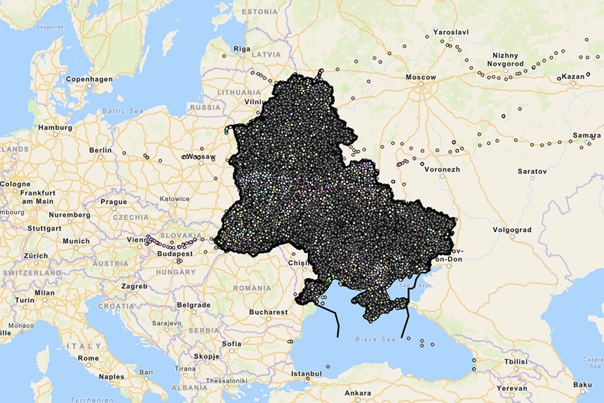
Pirtuni lies in Eastern Europe on the northern shore of the Black Sea. Eastern Europe includes a number of politically Western-oriented nations, including some that have recently joined the NATO alliance, and a counterpart grouping of nations that maintain strong economic, political, and military ties with Donovia, historically regarded as the regional superpower. Pirtuni possesses just over 230,000 square miles of territory that shares a 1,200-mile border with Donovia on its east and an eclectic mix of European nation-states on its west and north. The country’s southern border abuts the Black Sea and Sea of Azov. The region holds large oil and natural gas reserves that have enhanced the geostrategic importance of both Pirtuni and Donovia. Although the latter boasts the lion’s share of natural resources, the region’s economic well-being depends largely on the unimpeded flow of hydrocarbon products through nearly 35,000 miles of pipelines that crisscross Pirtunian territory.
Southeastern Europe has a long history of warfare, ethnic and religious strife, and high levels of civil unrest. In addition to indigenous divisions and stressors, outside actors that include the US, the European Union (EU), and other major players in the international community are taking an increased interest in the geopolitical dynamics of the region, all seeking to improve their relative position on the world stage.
Related Products
War in Ukraine Sociocultural Running Estimate 20 – Peripheral Impacts: The Baltics
ATP 7-100.1, Russian Tactics: Strike and Fires
Kazakhstan Expands Opportunities for Volunteers To Join the Armed Forces
Latin America’s Dictators Scramble To Join BRICS
Maduro Shakes Up Top Security Posts in Venezuela Following Disputed Election
India’s UAV Development Struggles to Take Off
ATP 7-100.1 Russian Tactics – How Russia Views the Strategic Environment
TRADOC G2 Newsletter August 2021 Vol. II (Iss.1)


